AERIALTRONICS
THE ALTURA ZENITH UAV. FLY TOMORROW’S INNOVATION TODAY
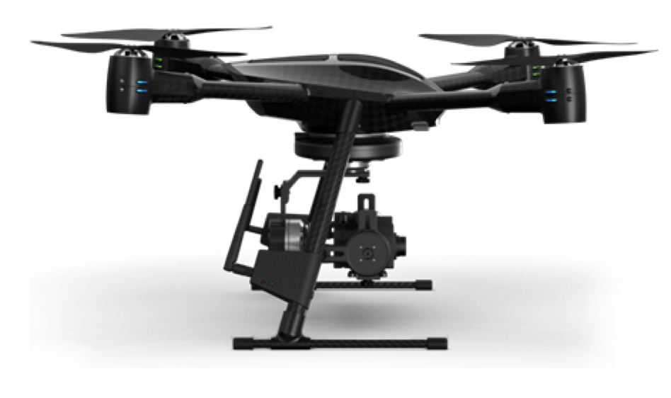
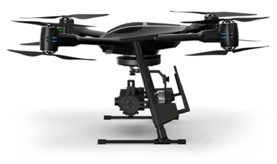
The Altura Zenith sets a precedent for the design of unmanned aircraft systems, by combining state of the art technology with remarkably flat, compact and lightweight design. Starting from scratch enabled the generation of a radically novel idea: developing a multi-rotor aircraft system that can meet a wide variety of application requirements without compromising on design.
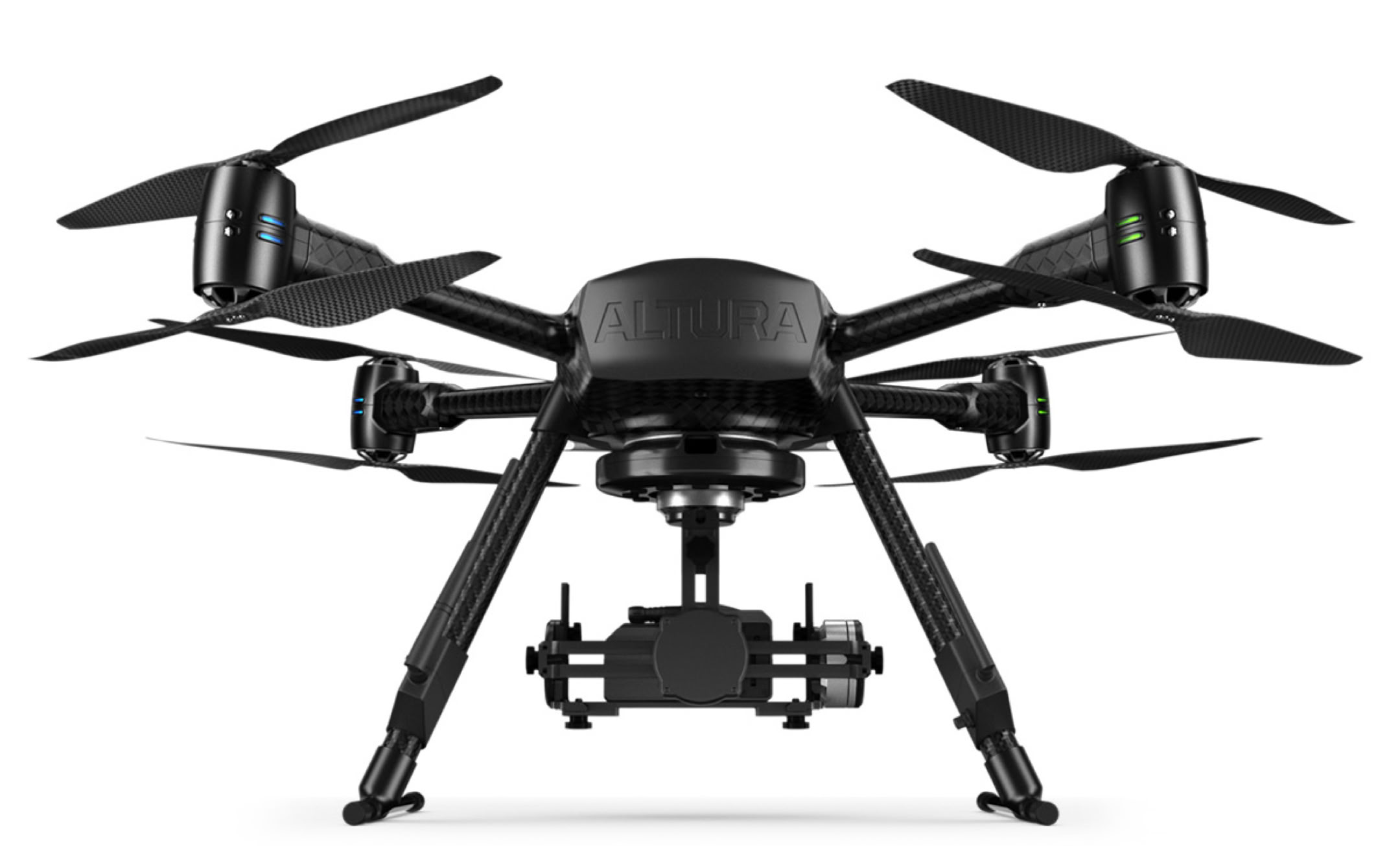
UNIQUE DESIGN - BEYOND THE CUTTING EDGE
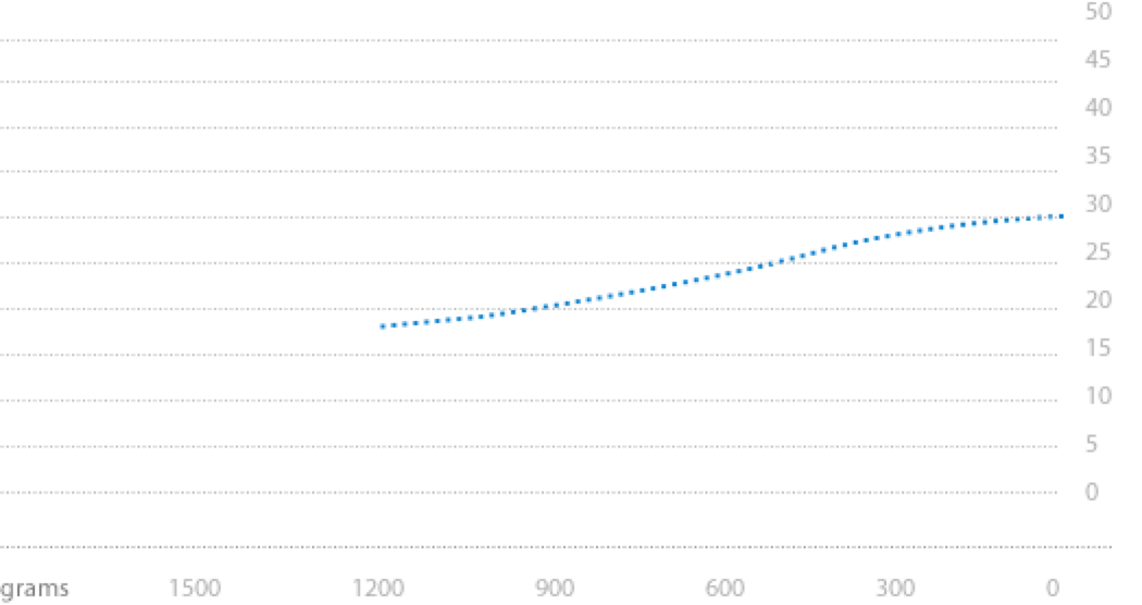
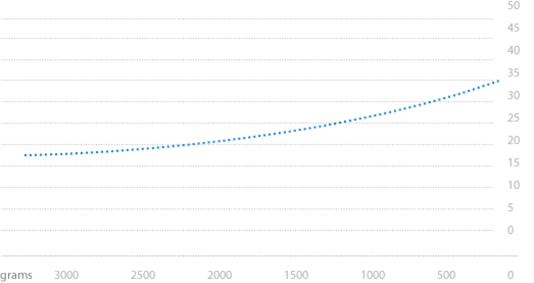
Performance and beauty are the cornerstones of the Altura Zenith. The structure was designed to enclose electrical components of the highest quality in a streamlined manner. Hidden within a super flat design, the Zenith carries a 10.000 or 20.000 mAh battery, which facilitates up to 35 minutes of flight time with total payloads of up to 1.2 kg for the ATX4 and 2.9 kg for the ATX8. All parts of the Zenith are carefully selected to form the best-balanced aircraft of today. Join the best, fly Zenith.

ALTURA GROUND CONTROL SYSTEM
The Altura Ground Control System (GCS) is one of a kind. All of its capabilities are featured on a simple overview to facilitate the control of the entire system. The pilot can manually control the position of the system and operate its payload with unparalleled ease. On an elegant tablet attached to the GCS the pilot operates our in-house app for autonomous navigation, waypoint triangulation and repetitive flight patterns
ALL IN ONE - LIGHTWEIGHT, COMPACT DESIGN
All of the Zenith’s functions are easily controlled with the ergonomic design of the ground control station (GCS) and the GCS tablet app. This set up guarantees ease of use for an effective deployment of the Unmanned Aerial System (UAS). The operator can simultaneously manoeuvre the system and manage the GCS. All of the Zenith’s operations are within one simple touch
THE ALTURA GCS APP
Aerialtronics spends a lot of time optimising system controls. The Altura GCS app manages both autonomous navigation as well as fully manual flights easily. Pilots can opt to navigate via waypoint or repetitive flight patterns. The interface is designed to enable flying for everyone within a couple of hours of training.
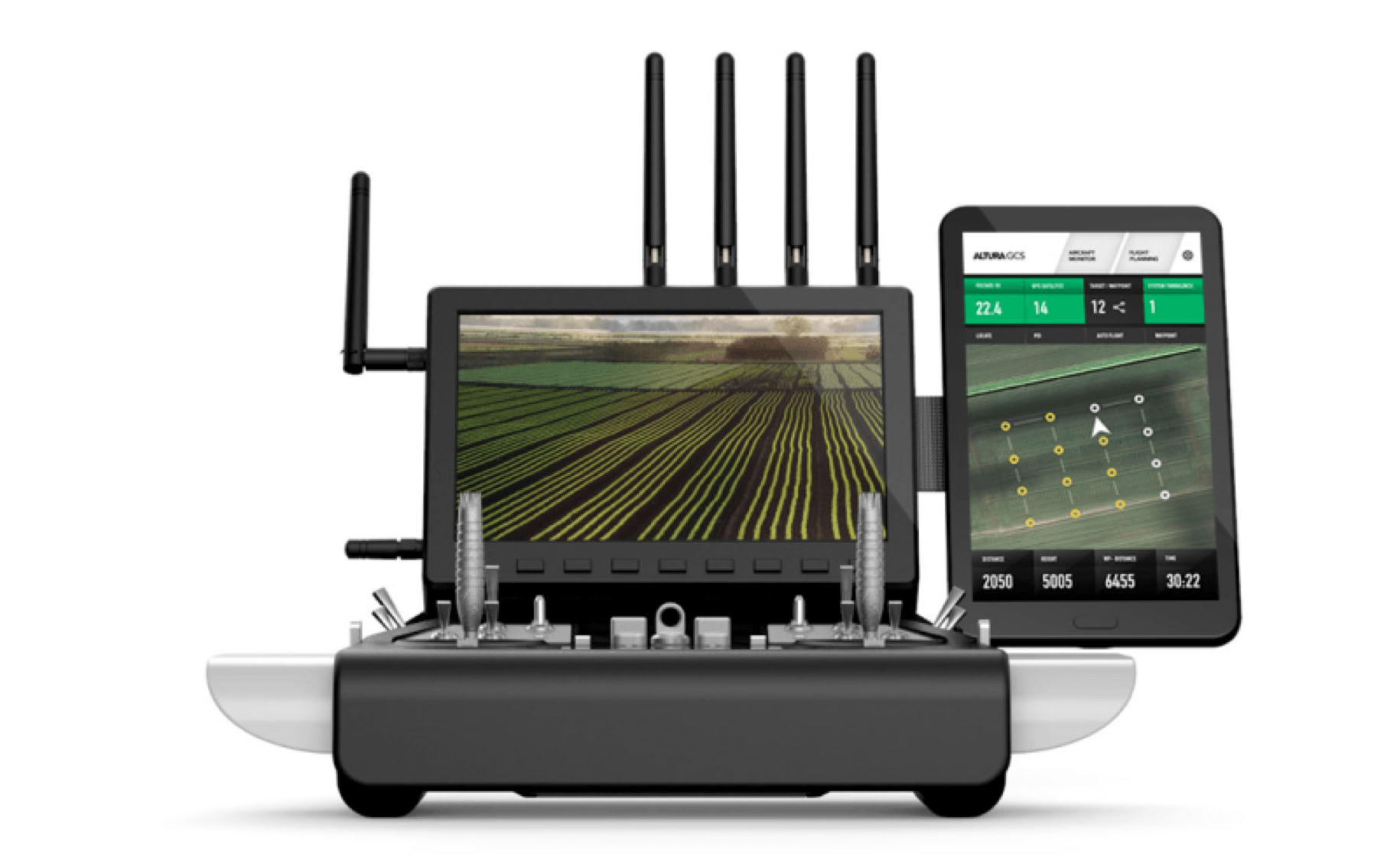
AIRCRAFT TELEMETRY & STATUS
The Altura GCS app provides a detailed overview of the aircraft status such as location, battery info and GPS
PHOTOGRAMMETRY & MAPPING
Easily pre-define flight grids, after launching the Zenith, software takes control, navigates and takes pictures according to grid.
AUTOMATE WITH WAYPOINTS
Fly autonomously along pre-defined flight paths and independently gather the required data
AIRCRAFT HEADING
LOCK
This mode will cause the Zenith to remember which direction is “forward” so you don’t have to worry about the aircraft heading during flight
FLYING MODES - DOG MODE & FOLLOW ME
The Altura Zenith autonomously follows and films you when carrying GPS enabled GCS tablet
VIRTUAL FENCE & SAFE ZONES
The Zenith can be flown within its virtual shelter of which it can’t leave the virtual pre-defined flight radius or maximum altitude
AUTO TAKE-OFF & LANDING
Do not worry about take-off and landing. It is now possible to precisely start, take-off and land the Zenith by a flick of a switch
AIRCRAFT CONFIGURATION
The Altura GCS app enables you to adjust functions such as payload settings, cruise-speed, max-altitude and flight distance
Joystick RF control
For optimal control
All systems are equipped with an RF radio control module that enables full manual control by a single pilot. The operator can manage the flight, payload or camera functions from the ground. This module is ideal for high-end photography or videography, which requires precise handling. Additionally, the module offers functions such as GPS position-hold, altitude control, go-home, auto-landing and camera control functions.
Dual operation
Focus on flight as well as payload
In the dual operation mode, the system is configured with a second control unit to facilitate a focus on both the flight as well as the payload configuration. This allows the users to perform safe, steady flights while delivering optimal data or imagery.

MANUAL CONTROL
Pilots can manually adjust the flight direction, cruise speed and have full control on all payload features from the ground
GPS ASSISTED FLIGHTS
The pre-programmed switches allow the pilot to switch between various flight modes, such as GPS/Altitude hold, coming home and landing
AIRCRAFT TELEMETRY & STATUS
The RF controller is provided with an build-in LCD status monitor, which provides you with the most important aircraft status information
PAYLOD OR CAMERA CONTROL
Pilots can remotely adjust the payload tilt and panning angle and have full control on all payload features from the ground at the same time
PAYLOAD OPTIONS
FIT ANY PAYLOAD YOU PREFER
The Zenith can be equipped with a wide variety of payloads, such as DSLR or cinema cameras, special sensors like thermal imaging, UV or multispectral cameras, sniffers and microphones. There are no restrictions in flexibility. You can fit any camera you choose. The Zenith will suit your application.
CLICK ’N GO PAYLOAD GIMBALS
Aerialtronics is a preferred supplier of the famous Photo Higher servo-driven gimbals, which are developed in New Zealand. Photo Higher provides maximum flexibility due to the compatibility of its AV200 and AV130 gimbals with medium and large-sized cameras. The clever servo-driven propulsion systems enable maximum image stability without having to adjust for the centre point of gravity. The quality of your images is key. Therefore, stability is a must. The 2- and 3- axis brushless stabilised gimbals are especially developed for small to intermediate sized cameras that weigh up to 1 kg. Even cameras that lack proper optical (image) stabilisation, like thermal cameras, can provide stabilised images with the brushless gimbal. The stable recordings alleviate the need for post stabilisation and post-production, which leads to a significant time save.



A WORLD OF APPLICATIONS, A WIDE VARIETY OF SENSORS
THERMAL VISION SENSORS
With advanced thermal and vision cameras, the UAS records vast amounts of data for optimal workflow solutions. Developed by Aerialtronics, The Dupla Vista allows the pilot to switch between infrared thermal and vision cameras for specialist missions. This technology enables the pilot to timely evaluate, analyse and interpret data for tangible results.
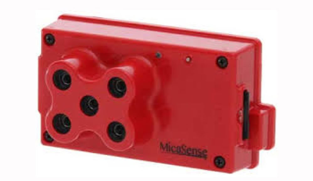
MULTISPECTRAL
Impressive Agriculture data at your fingertips
The Multispectral sensor is an advanced, lightweight, multispectral camera optimized for use with the Altura Zenith. By combining the multispectral sensor with the Zenith, we provide accurate multi-band data for agricultural remote sensing solutions. The applications of the multispectral camera provide new perspectives on the health of crops. Agronomists can effectively detect and manage areas that need more attention for optimal output.
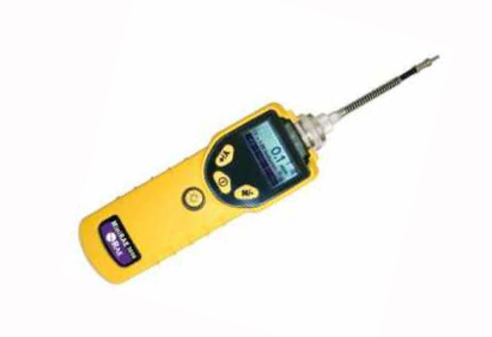
SNIFFER / VOC MONITOR
The most advanced VOC capabilities on the market
The VOC monitor is an advanced piece of technology that can be used for industrial hygiene, detection of gas leaks and hazardous materials. It is equipped with a photoionization detector with a detection range between 0-15.00 ppm, a three-second response time, embedded correction factors for more than 200 compounds, and a unique auto-cleaning sensor technology. The VOC monitor can analyse more chemicals at an unparalleled speed. Thanks to its dust-tight and waterproof casing, it can even be deployed in the harshest conditions.
PENSAR
30x optical zoom, IR - thermal and sensor fusion, AI enabled, world’s first dual spectrum computer vision platform with deep learning capabilities. PENSAR is a stand-alone twin sensor platform that utilizes the GPU-accelerated computing power of the award-winning NVIDIA® Jetson™ module to allow for real-time video processing and immediate augmented insights.
.
PHOTO CAMERAS / VIDEO CAMERAS
WIDEST SENSOR RANGE ON UAV MARKET
Altura Zenith unmanned aircraft system offers the perfect solution for stable aerial photography and film. The gimbal empowers the photographer or cinema director to shoot impressively stable pictures. Even if the camera attached to the gimbal is not equipped with a stabiliser option, it will shoot remarkably steady images. The unmanned aircraft system can fly up to 45min in conditions varying between heavy rain, beautiful sunshine, freezing snow and strong winds. At all times, the pilot can control the UAS and payload with hawk eye precision.

COMPARISON OVERVIEW
Payload ATX8

Max. take-off weight
5.0 kg

Max payload ATX4
1.2 kg

Take-off weight
6.65 kg

Max payload ATX8
2.9 kg

Max flight time
Up to 30 minutes

Battery
22.2V - 10.000 mAh

Max flight time
Up to 35 minutes

Battery
22.2V - 20.000 mAh

Max wind speed
Up to 8 m/s

Weather
Dry to light rain or snow

Max wind speed
Up to 12 m/s

Weather
Dry to light rain or snow

Max cruise speed
10 m/s

Average cruise speed
5 m/s (adjustable)

Max cruise speed
20 m/s

Average cruise speed
5 m/s (adjustable)
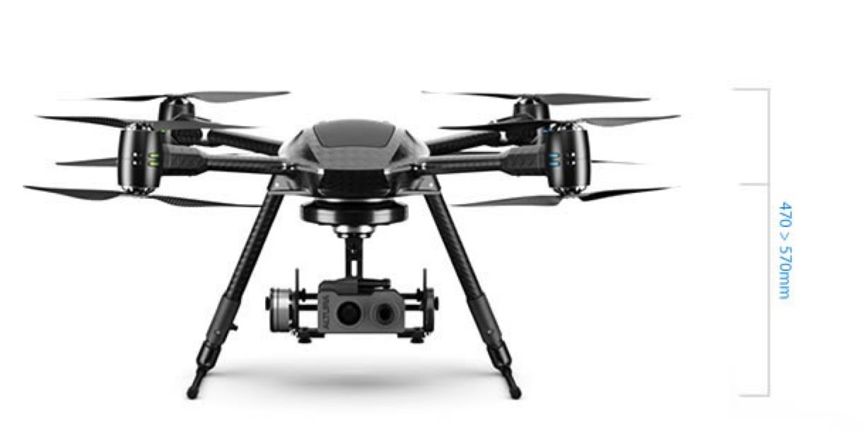
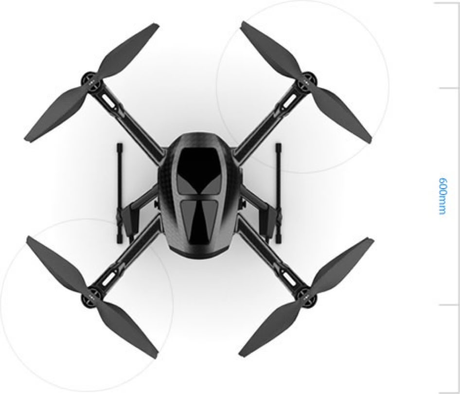
Length x Width
600 x 600 mm
Height
470 - 570 mm
MTOW ATX4
5.0 kg
MTOW ATX8
9.65 kg
Controller frequency
2.4 Ghz
Telemetry frequency
Variable
Video frequency
5.1 - 5.8 Ghz
Range
1000m
Controller frequency
2.4 Ghz
Telemetry frequency
Variable
Video frequency
5.1 - 5.8 Ghz
Range
1000m
Control Functions
12 channel manual RF control
GPS / Altitude hold
Auto go home and landing
Camera angle control
Camera shutter and zoom
Multiple camera switching
Automatic fail-safe system (signal loss)
Telemetry (data display)
Battery voltage (V)
Battery usage (mAh)
Range / Signal status
Control Functions
Auto take-off and landing
Auto go home and landing
GPS waypoint navigation
Camera point of interest
GIS mapping
Telemetry (data display)
Battery voltage (V)
Altitude & distance (meters)
GPS longitude / Latitude coordinates
Number of GPS satellites
Flight time (min)
Flight mode
System state
Joystick display
Battery usage
MORE INFORMATION
Southern Cross Drones offers full range of Aerialtronics Altura Zenith multi-rotor drones to customers in Australia, New Zealand and APAC region. For more information about Aerialtronics drone solutions and to order please contact us by sending message to info@southerncrossdrones.com
Copyright © 2024 Southern Cross Drones Pty Ltd . All Rights Reserved