WINGTRA
FLY LIKE A PLANE. TAKE OFF AND LAND LIKE HELICOPTER
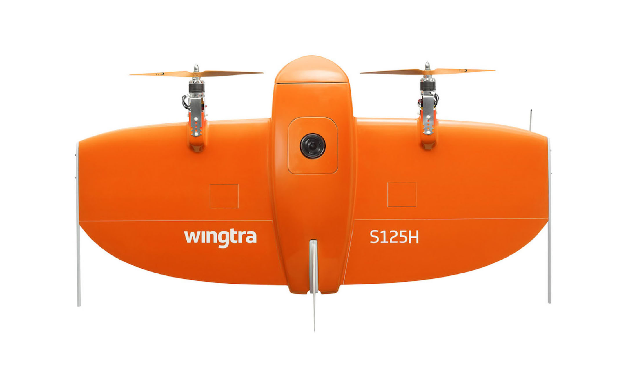
Wingtra developed a new category of drones. The WingtraOne drastically simplifies how aerial data is collected. Wingtra aims to have a positive impact for the human condition on a large scale. We do this through technology and robots.
While conventional quadcopters are limited in range and speed, fixed wing airplanes need catapults and runways. Wingtra’s hybrid drone combines the advantages of both worlds. It is as agile as multicopters and has the superior flight capability of a fixed-wing aircraft regarding range and speed. It opens new possibilities in improving wildlife protection, agriculture, parcel delivery, and many other applications.
KEY FEATURES
KEY FEATURES
EASY TO USE
• Fully autonomous missions from take-off to landing – no piloting skills required
• Vertical take-off – no hand launch, no catapult needed
• Land vertically on the spot – no more belly landings, no nets to catch it, no parachutes needed
• Intuitive mission planning on tablet and laptop with WingtraPilot
CHOOSE YOUR SENSOR
• The WingtraOne can carry any sensor with a weight of up to 800g
• Already integrated sensors: Sony QX1 (RGB), Sony RX1RII (high-end RGB), Micasense RedEdge (5 band multispectral)
• Option to integrate high precision GNSS (PPK)
FLY EVERYWHERE
• Take off and land in difficult terrain such as confined spaces (e.g. forests), hilly terrain and rocky grounds (e.g. open-pit mines)
• Vertical landing where you want it – save time instead of searching for appropriate landing sites
• Next generation of fixed wings – accomplish missions you couldn’t do before
COVER MORE
• Cover 10 times more area than with a multirotor
• 300ha+ coverage at 3cm/px ground sampling distance (Sony QX1 / 16mm lens)

SPECIFICATIONS
WINGTRAONE
Wingspan
Weight (empty)
Maximum Take-off Weight
Mission Planning Software
Take-off and Landing
Optimal Cruise Speed
Wind Resistance
Payload Capacity
Flight Time
125cm
3.6kg
4.4kg
WingtraPilot
Fully autonomous at GPS accuracy
55km/h
up to 35km/h during landing, 45km/h in cruise
up to 800g
up to 55 min
CAMERAS
Sony QX1 / 16mm lens
Area coverage in one flight
Sony RX1RII / 35mm lens
Area coverage in one flight
Micasense Rededge / 5.5mm Lens
Area coverage in one flight
300+ ha
with side overlap 60%, GSD: 3cm/px, Flight altitude 113m
200+ ha
with side overlap 60%, GSD: 1.5cm/px, Flight altitude 120m
150+ ha
with side overlap 70%, GSD: 8cm/px, Flight altitude 120m
WINGTRAONE WORKFLOW
1. Plan your mission with the WingtraPilot
2. Take off vertically
3. Land fully autonomously
4. Get the data out
Mission planning has never been easier. Using the intuitive touch interface, you simply highlight the area you want to map and WingtraPilot automatically calculates the optimal flight path. Throughout the flight, you can monitor your WingtraOne in real time.
Launching the aircraft is very simple. You don’t need to throw the aircraft or set up a catapult in advance. Simply remove your WingtraOne from the lightweight, yet rugged, backpack, place it on the ground and confirm the take-off on the tablet. Then just watch it take off to a fully autonomous surveying mission.
Landing is as easy as taking off and is also done fully automated. The landing is done vertically at GPS accuracy, even in confined areas. Thanks to the smooth descent your sensors don’t run the risk of getting damaged in a belly landing. Vegetation, rocky ground and hilly terrain will not hinder you from selecting your landing spot.
The geotagged images are saved on the sd card of your sensor and are ready to get processed. This way you can transfer even large amounts of data easily onto your computer. Our data output is compatible with all mapping software, allowing you to rely on the one that best serves your needs.


Copyright © 2024 Southern Cross Drones Pty Ltd . All Rights Reserved